A golf course renovation starts long before the first cart path gets torn out. The design team needs a clear picture of the course as it sits today, and on a property this big, that picture covers a lot of ground. Drone surveying can capture much of it from the air, but the team has to plan what to collect before anyone flies.
Courses in and around Bethesda need one more planning step. Bethesda sits inside the 15-mile ring around Reagan National Airport, and the FAA prohibits drone flights there without specific authorization. That approval takes time, so the survey schedule should allow for it from day one.
Map Existing Course Features Before Redesign Begins
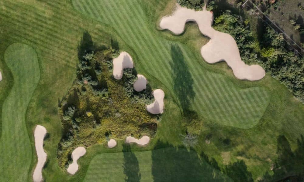
Start with a record of what’s already on the ground. An existing conditions survey shows the course as it stands before the redesign changes anything. For a golf course, that record usually covers greens, tees, bunkers, fairway edges, cart paths, bridges, buildings, parking areas and visible drainage features like inlets and ditches.
Designers treat that record as their starting point. A golf course architect can’t redraw a green complex without knowing where the current one sits and how it ties into the paths and slopes around it. A civil engineer laying out a new parking lot beside an old maintenance building faces the same problem.
A course spreads its features across many holes and many acres. Aerial capture lets the surveyor record that layout as one connected picture. The surveyor then turns the imagery into maps and CAD linework that the design team can build from.
Match Survey Detail to the Renovation Scope
The renovation plan should decide what the survey captures. A project that only replaces cart paths and parking doesn’t need the same detail as one that reshapes holes or regrades fairways. Asking for everything everywhere can add cost and time without giving the designers anything they’ll use.
Montgomery County offers a real example of a narrower scope. The county’s capital budget lists improvements at Falls Road Golf Course in Potomac, with plans to renovate existing cart paths, add new ones and replace the parking lot. A survey for that kind of work would focus on path routes, pavement edges, nearby grades and the parking area rather than every green on the property.
Before anyone sets the scope, get the golf course architect, civil engineer, landscape architect and contractor talking with the surveyor. Each one needs different information. The architect may care most about green and tee shapes, while the engineer wants drainage paths and the contractor wants clear limits for the work zone.
Identify Terrain Changes That Could Affect Design
Visible features tell only part of the story. The design team also needs to know how the ground rises and falls, because grades and slopes affect play, drainage and where new paths can go.
With the right equipment and ground control, a drone survey can produce elevation data across the open parts of a course. Ground control points are marked targets that the crew measures on the ground to tie the aerial data to real coordinates. The surveyor can then build contour maps or a digital terrain model, which is a 3D surface of the ground that designers load into their software.
Terrain data matters most where the renovation will move soil. A rebuilt green or a cart path climbing a steep slope depends on accurate existing grades. Low spots that hold water after a storm deserve attention too, since a design that misses them can send runoff right back onto the new work.
Plan Around Areas the Drone Cannot Reliably Capture
A drone records what it can see from above, and some parts of a golf course stay hidden. Tree lines, wooded strips between holes, building overhangs and shaded cart paths can block a clear view of the ground. Ponds add another gap, because standard aerial methods don’t map the bottom of the water.
Name these areas before the flight. The surveyor can mark them for supplemental field surveying with conventional ground equipment. Planning that work up front keeps the schedule realistic and prevents a hole in the data right where a designer needs it.
Some golf course details sit at a small scale too. Bunker edges, curbs and the lip where a cart path meets turf can call for closer field shots. Ask the surveyor which features the aerial data will show well and which ones a crew should measure on foot.
Define Deliverables Before the Renovation Survey Starts
Settle the details of your request before the survey gets scheduled. A clear request helps the surveyor price the job and plan both the flight and the field work. It also means the design team gets files they can open and use right away.
Have these items ready when you reach out:
- Project limits, including which holes or areas fall inside the work zone
- The features the design team needs on the map
- The level of elevation detail, such as the contour interval
- Any coordinate system, CAD format or drawing template the designers require
- How the team plans to use the survey, from concept design to grading plans or bids
- Areas that will likely need conventional field surveying
If nobody has settled the scope yet, a short call between the surveyor and the designers can sort it out before anyone spends money. That conversation often shrinks the survey to what the project needs. It can also catch a missing item while it’s still cheap to add.
Frequently Asked Questions
Can drone surveying be completed while a golf course remains open?
Sometimes, but it takes planning with the course staff. Crews often fly during early mornings, slow days or on closed holes so golfers stay clear and play doesn’t stop the work. Whether the course can stay fully open depends on the site and the flight plan, so talk it through with the surveyor and the course manager first.
Should the entire golf course be surveyed for a partial renovation?
Not always. The survey limits should follow the design scope, plus enough room around it to show how new work connects to what stays. A bunker project on three holes might only need those holes and the slopes that drain toward them, so ask your designers where their work ends and how far past that line they need data.
Can drone surveying document golf course irrigation features?
A drone can pick up irrigation parts that sit on the surface, such as valve boxes, pump houses and sprinkler heads that show clearly in open turf. It can’t find the pipes and wires buried below. For those, the team will need as-built records, utility locating or a crew working on the ground.