Giving land to a city or county for a road sounds simple. You sign a form, and a strip of your lot becomes public. In practice, that strip can change your lot lines, your setbacks, and the value of what’s left. Good land surveying shows exactly where the new line falls before you agree to anything, so you know what you’re giving up and what you keep.
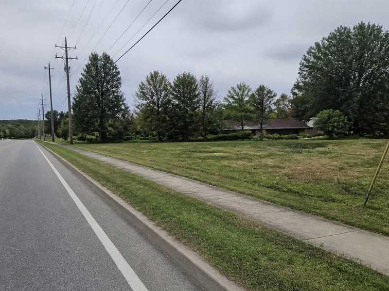
Most dedications come up during site plan or subdivision review. A local agency may ask for land along the front of a lot to widen a road, add a sidewalk, or make room for utilities. This guide walks through the survey work behind that request. You’ll learn what to check, what to ask, and what to have ready for review.
Public Right-of-Way Dedication and Its Impact on Property Ownership
A public right-of-way dedication is a transfer of land, or rights in land, to a public agency for roads, sidewalks, or utilities. Once the agency accepts it, you usually lose control of that strip. Depending on how the document is written, the agency may own the land outright or hold rights to use it. These terms can vary by agency and by the wording of the dedication itself.
The biggest change is often your lot size. Setbacks are commonly measured from the right-of-way line, so a new front line can push your buildable area back. Lot area and frontage figures used for zoning may shrink too. That can affect how much you’re allowed to build, so ask the planning office how they measure from a dedicated line.
Bring your attorney and title company in early. They can explain how the transfer affects ownership and title. A survey can’t answer legal questions, but it gives everyone the same accurate picture to work from.
Boundary Surveys and the Proposed Dedication Area
A boundary survey is the starting point because the dedication line is measured from your existing property lines. If the boundary is off, the dedication will be off too. The surveyor researches deeds, plats, and road records, then finds monuments in the field. Those findings set the base for every drawing that follows.
Many older roads were built long before modern surveys. The edge of the pavement often doesn’t match the record right-of-way line. In some cases, part of the road already sits on private land. A surveyor will show where the record line, the pavement, and your lot line actually fall.
What to Check Inside the Proposed Strip
Once the boundary is set, the surveyor plots the proposed dedication area. Look closely at what lands inside it. Items that often show up in that strip include:
- Driveways, curbs, walls, signs, or parking spaces
- Fences, trees, or landscaping you planned to keep
- Wells, septic parts, or stormwater features
- Building corners or porches close to the new line
If something important falls inside the strip, raise it with the reviewing agency before the plat is final. Sometimes the width or shape can be discussed. Even when it can’t, you’ll know the cost up front instead of finding out during construction.
Existing Easements, Utilities, and Access Restrictions
Before you dedicate land, you need to know what rights others already hold on it. Easements for utilities, drainage, or access may already cross the strip. A title report lists recorded easements, and the survey shows where they sit on the ground. Together, they explain how the new dedication will interact with rights that already exist.
Surveyors usually map visible utility features like poles, valves, manholes, and boxes. Underground lines may need a utility locate or records from the utility owner. Ask your surveyor what level of utility mapping is included. It can vary a lot by project scope.
Dedications sometimes come with access limits. An agency might restrict new driveway openings or require shared access along a busy road. Those terms can shape your site layout for years. Read any access conditions closely and confirm them with the agency and your engineer.
Land Surveying Requirements for Dedication Plats and Legal Descriptions
Most agencies require a dedication plat, a legal description, or both. The plat is a drawing that shows the strip, its size, and how it ties to your property. The legal description puts the same strip into words, using directions, distances, and reference points. Formats can vary by municipality, county, and project type, so ask for the agency’s checklist before drafting starts.
What a Dedication Plat Usually Shows
Plats often show the original parcel, the dedication area, and the lot that remains. They tend to list square footage or acreage for each part. Monuments, curve data, and nearby road names are common too. Some agencies also want certain notes, signature blocks, or a set sheet size.
Why the Legal Description Matters
The legal description becomes part of the recorded dedication document. It has to match the plat line for line. A small error in a direction or distance can leave a gap or overlap that causes title trouble later. Have your surveyor and attorney compare both documents side by side before anyone signs.
Final Survey Documentation for Municipal Review and Recording
Final documentation is the package the agency reviews and then records in the land records. It usually includes the signed and sealed plat, the legal description, and any required forms. Review comments are common, and a round or two of changes is normal. Plan for that time so permits and closings don’t slip.
After approval, the documents are recorded and the dedication becomes part of the public record. Keep copies of the recorded plat and description with your property files. Future buyers, lenders, and title companies will likely ask for them. Your surveyor may also set new markers at the corners of the remaining lot so the new lines are easy to find.
If a closing, loan, or building permit depends on the dedication, start the survey early. Ask your surveyor how long field work and drafting will take. Ask the agency how long review usually runs. Small delays at each step can add up fast.
Frequently Asked Questions
Do I get paid for a right-of-way dedication?
Not always. Many dedications are required as a condition of site plan or subdivision approval, and no payment changes hands. In other cases, an agency may buy the land through a separate purchase process. Ask your attorney which situation applies to your property before you agree to terms.
Can I still use the land after I dedicate it?
In most cases, your control over the strip ends once the agency accepts it. Some agencies allow limited uses, like a driveway crossing, with a permit. The rules depend on the agency and the wording of the dedication. Get any planned use confirmed in writing before you count on it.
How long does a dedication survey take?
It depends on the size of the property, the records available, and the agency’s review process. A small home lot usually moves faster than a large commercial site with many easements. Research, field work, drafting, and review each add time. Ask your surveyor for a realistic schedule at the start so you can plan around it.