If you own or plan to redevelop an old industrial site, the ground probably has a mixed history. Old buildings can leave behind uneven grades. They can leave buried footings, filled-in low spots, and drainage that doesn’t match any current site plan. Before you design anything new, you need to know what the land looks like today. That’s where lidar mapping helps.
Lidar mapping uses a laser scanner to collect data across a site. The scanner is often mounted on a drone or a vehicle. It gathers millions of exact elevation points. Those points build a detailed map of the surface. This map shows grade changes, drainage paths, and other features. It captures far more detail than older survey methods, especially on a large or overgrown property.
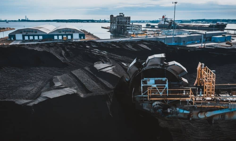
Baltimore has many sites like this. Years of manufacturing, shipping, and heavy industry left behind uneven ground and old drainage systems. These systems were never built with future redevelopment in mind. Lidar mapping gives developers and engineers a clear starting point based on real conditions, not just old plans or aerial photos.
Mapping Existing Site Conditions Before Redevelopment Begins
Before any redevelopment plan takes shape, someone needs to record what the site looks like now. Lidar mapping does this by scanning the whole property. It turns that scan into a detailed elevation model.
This model shows more than high points and low points. It picks up pavement edges, retaining walls, and drainage paths. These details often don’t match old site plans. Buildings get torn down. Utilities get left in the ground. Grading changes over time. Nobody updates the old records.
This current model gives everyone on the project the same starting point. The developer, the engineer, and other team members all work from real site conditions. Nobody has to guess based on outdated drawings.
Identifying Terrain Constraints Across Complex Brownfield Sites
Brownfield sites are rarely flat or simple. Many were graded and regraded several times for different industrial uses. This can leave behind slopes, low spots, and drainage patterns that create real problems for redevelopment.
Lidar mapping helps spot these problems early. This happens before a design team commits to a layout that might not work. Steep slopes can limit where buildings, parking, and roads can go. Low spots that collect water may need fixing before construction starts. Old berms or fill areas can also change how stormwater moves across the site.
Finding these issues during the mapping stage gives the team time to plan around them. This might mean changing a building’s shape. It might mean rethinking how stormwater will drain. It might mean flagging an area for a closer look before design moves ahead.
Building a Spatial Base for Cleanup and Redevelopment Planning
Brownfield redevelopment almost always includes some environmental cleanup along with design work. Both jobs work better when everyone uses the same accurate map of the site.
The elevation model from lidar mapping can act as a shared reference for different teams. Environmental consultants can use it to plan where to test the soil. Civil engineers can use it to test grading ideas against real conditions. Since everyone works from the same map, there’s less chance of confusion about where a slope, drain, or old structure sits.
This shared map also helps when cleanup happens in stages. As the cleanup moves forward and conditions change, the original lidar map still gives the team a steady point of comparison.
Coordinating LiDAR Data With Brownfield Records
Many brownfield properties have a history tied to programs like Maryland’s Voluntary Cleanup Program. They may also have older land use and permit records held by the city or state. Lidar mapping data works alongside these records. It does not replace them.
Comparing the current surface map to old site plans or past reports can be useful. It can help confirm whether a feature from the records, like an old building footprint or a buried tank, still shows up on the surface today. Sometimes a feature from the records is no longer visible. That’s useful for the environmental and engineering teams to know before they finish planning their work.
This kind of check does not replace a title search. It does not replace a review of environmental records or contact with the right agency. It simply gives the team another layer of accurate site information to check old records against. That can help avoid surprises later.
Carrying Site Data Into Brownfield Redevelopment Design
Once the site is mapped and the ground problems are known, that information needs to move into the design process. It shouldn’t just sit in a report.
The lidar-based map can be shared with architects, engineers, and site planners. It can be shared in formats that work directly with their design software. That means grading plans, stormwater designs, and building layouts can be built around real site conditions from day one. They don’t need fixing later once problems show up during construction.
This step matters most on brownfield sites. The gap between what people assume about a site and what’s actually there can be large. A design built on accurate lidar data is much less likely to run into grading surprises or drainage problems once construction begins.