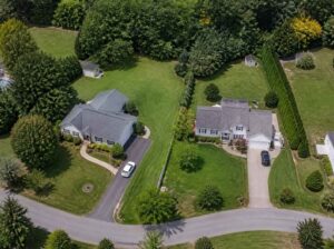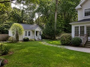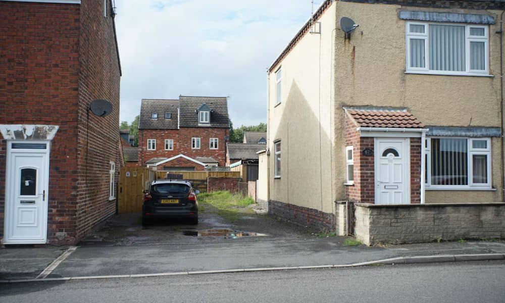
You own a deep lot with open land behind your house, and you’d like to split off the back part for a new home. The rear land has one big problem. It doesn’t touch the street, so it needs a long, narrow strip of land to reach the road. Planners call this shape a flag lot or a panhandle lot. The rear piece is the flag, and the strip is the pole.
A subdivision survey shows whether that plan fits your land before you pay for house plans or city review. Baltimore City’s Rules and Regulations for Land Subdivision recognize panhandle lots. The city’s zoning code also bars any land division that would break the rules for the original lot or the new lots. So the strip, the rear lot and the house you keep all have to work. Baltimore County has its own rules, so confirm which one covers your land before you plan around any number.
Assessing the Rear Parcel and Access Strip for Land Division
Start with one test. Your parcel needs room for a usable rear lot and a strip wide enough to reach the street, with enough left over for the front house. A surveyor checks this by pulling your deed and past plats, then measuring what’s actually on the ground. The results show your true lot lines, the size of the parcel and where each building sits.
The side yard tells you a lot. The strip almost always runs beside the front house, so the gap between that house and your side line sets your limit. If the house sits close to the line, the strip may not fit. Even when it fits, it could leave the front house with a side yard that’s too small.
That second problem matters in Baltimore City. Under the zoning code, the yards and open space a building needs must stay on the same lot as that building. You can’t hand part of your house’s required yard to the new strip. The surveyor’s map of the house, porch, steps, garage and fences shows how much room you really have.
Mapping the Flag Lot’s Access, Width, and Buildable Area
Once the basic fit looks possible, your surveyor draws the new lots with real dimensions. The drawing has to show how wide the strip is, how long it runs and how much of the rear lot you can build on. Those numbers decide whether the idea holds up in review.
Strip width and length
Local rules control how wide a strip must be and how long it can run. Baltimore City’s subdivision rules include lot frontage requirements, and your zoning district sets other limits. Other counties set their own panhandle widths and length caps, so a number from one county won’t carry over to another. Ask the planning office which standards apply before your surveyor fixes any lines.
The strip also has to work as a driveway. A topographic survey shows the slope from the street to the rear lot, along with spots where water collects. A steep or uneven strip can make a driveway hard to build. Reviewers may also ask how emergency vehicles would reach the rear house.
Buildable area on the rear lot
The flag needs space for a house after the setbacks come off. Setbacks are the minimum distances a building has to keep from each lot line. A rear lot can look large on a tax map and still shrink fast once those lines go on the drawing. Some places don’t count the strip toward a lot’s required area, so ask how your jurisdiction treats it.
Checking Easements, Utilities, and Drainage Along the Access Strip
The strip usually carries more than a driveway. Water, sewer, gas and power for the new house often have to run down that same narrow path. If something already sits there, you may have less room than the plan shows.
A surveyor and a title report can turn up items like these along the strip:
- Water or sewer lines that serve the front house
- Recorded utility easements that give a company rights to part of the strip
- Overhead power lines or poles near the street
- Storm drains, inlets or low spots that carry runoff
- An old shared driveway or walkway a neighbor uses
Drainage is easy to overlook. A new paved driveway sends more water downhill, and that water can end up against the front house or in a neighbor’s yard. The survey’s ground elevations help an engineer plan where the runoff will go. Fixing a drainage problem on paper costs far less than fixing it after the driveway goes in.
Coordinating the Proposed Subdivision Plat With Local Requirements
A subdivision plat is the formal drawing of the new lots. It shows each new line with its length and direction, plus the strip, any easements and the area of each lot. Your surveyor prepares it from the field work and the record research.
In Baltimore City, the Planning Commission publishes the land subdivision rules. The process uses preliminary and final subdivision plans, and city staff may ask for changes along the way. After approval, the plat goes on record in the land records. That recorded plat creates the new lot in the city’s records.
Talk with the Department of Planning early. Bring a rough sketch from your surveyor and ask what the city will want to see. If a lender or title company plays a role in your plans, bring them in at this stage too.
Resolving Flag Lot Design Issues Before Final Plat Submission
Most flag lot problems show up as soon as real numbers land on the drawing. The strip comes up a few feet short. The rear lot loses too much area to setbacks, or a sewer line sits right where the driveway needs to go.
You can often fix these before you submit the final plat. You might shift the strip to the other side of the house or move the line between the two lots. You might remove a shed or garage that blocks the strip. Sometimes a shared driveway agreement solves it, if local rules allow one. And sometimes the honest answer is that the parcel can’t hold a flag lot at all.
Hearing that early keeps you from paying for house plans on a lot that may never get approval. Ask your surveyor to walk you through each option and what it would change. Settle the design first, then submit the final plat.
Frequently Asked Questions
Can a flag lot share a driveway with the property in front?
It can in some places, but the details decide whether it works. A shared driveway needs a written agreement that grants each owner the right to use it. The agreement should spell out who pays for repairs, plowing and repaving. Local rules may also limit shared access, so check with the planning office and an attorney before you count on it.
Can a flag lot have a separate street address?
An address is its own step, apart from approving the lot. The city handles address assignment through a separate administrative process. Ask the Department of Planning which office takes address requests for a new lot. Confirm this before you sell the lot or apply for a building permit.
Does creating a flag lot affect the value of the original property?
It can, but no one can promise how. The front house ends up with less land, and a driveway may now run past its side yard. The new lot may also hold value as a home site of its own. A local appraiser or real estate agent can give you a better read on your market.