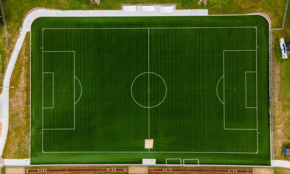
An athletic field that used to drain well can start holding water after years of play. A crown that once shed rain can flatten out over time. Sprinkler heads can end up buried under new sod. Before anyone draws up a renovation plan, someone needs a clear picture of what the field looks like right now. Not what the original design intended years ago. That’s what a topographic survey provides.
A topographic survey records the elevations and physical features across a site. For a field renovation, that means mapping the current playing surface, the grading around it, and any drainage or utility features nearby. Without this data, a design team is just guessing at slopes. With it, they’re working from real numbers.
Defining the Topographic Survey Limits
The first step is deciding how much ground the survey needs to cover. This isn’t always just the field itself.
A renovation project often needs data that goes past the edges of the playing surface. Sidelines, walkways, fencing, dugouts, bleacher pads, and nearby parking can all affect how the new field connects to the site around it. If the plan includes regrading near a fence line or fixing a drainage path that runs off the field, the survey needs to reach that far too.
Project scope drives this choice. A field getting new turf on the same footprint may only need the playing surface and a small buffer around it. A field getting a bigger regrading job, new underground drainage, or a change in shape needs a wider survey area. The surveyor and the design team should agree on these limits early. Expanding the area later, after fieldwork has already started, can slow the project down and add cost.
Mapping Surface Grades, Crowns, and Critical Breaklines
Once the limits are set, the survey focuses on the shape of the ground. This is where a topographic survey really earns its keep on a field renovation.
Most athletic fields use a crown, a slight high point that runs down the center or along one side, to push water off the surface. Over time, foot traffic and repeated maintenance can wear that crown down or shift it out of place. A topographic survey measures the real elevations across the field. This shows the design team exactly where the crown has flattened and by how much.
Breaklines matter just as much as the crown. A breakline is a spot where the slope changes direction, like where the field meets a swale, a curb, or a grassed edge. If these breaklines aren’t measured correctly, a new grading plan can end up fighting the existing slopes instead of working with them. Getting this right the first time helps avoid a costly redesign once the contractor starts moving dirt.
Documenting Drainage, Irrigation, and Visible Utility Features
A field renovation almost always runs into something buried or partly hidden below the surface. The survey needs to record what’s visible and what can be located before construction starts.
This includes drain inlets, catch basins, cleanouts, sprinkler heads, and control valve boxes. It also includes any utility markings left by a locate service. Some of these features may be buried under turf that has grown over them since the last renovation. Having a field crew walk the site with the surveyor, or sharing any old as-built drawings, can help make sure nothing gets missed.
Good documentation here protects the budget. If a new sprinkler head or drain line conflicts with something that wasn’t caught during the survey, the contractor may need to stop and adjust the plan mid-project. Confirming these features early, and checking them against any older site plans on file, cuts down on that risk.
Connecting Field Grades to Surrounding Site Improvements
An athletic field doesn’t sit on its own. It’s part of a larger site, and how it connects to that site affects how well the renovation performs once it’s done.
Walkways, parking areas, bleacher pads, dugouts, and nearby landscaped areas all tie into the field’s grading somewhere. If a survey only covers the field and skips these connection points, the new design can create problems. A walkway edge might no longer line up with the field surface. A low spot might form where two grading plans meet but don’t match.
For properties, this connection to the rest of the site often includes drainage that was designed for the whole property, not just the field. A topographic survey that shows how water currently moves across the broader site gives the design team a realistic starting point. That’s better than treating the field as its own separate project with its own drainage rules.
Preparing Renovation-Ready Data for the Project Team
Once the field data is collected, it needs to reach the design and construction teams in a usable format.
This usually means a topographic map or a digital terrain model. It should show contours, spot elevations, and the drainage or utility features found during the survey. Depending on the project, the surveyor may also provide a point file that can be loaded directly into design or grading software.
Talking with the civil engineer, landscape architect, or contractor early helps make sure the survey matches what they actually need. A design team using specific software, or planning to calculate cut-and-fill volumes for the regrading, may need the data in a certain format. Confirming this before the survey starts, instead of after the data is delivered, keeps the project on track.